The killing of Hamas leader Yahya Sinwar
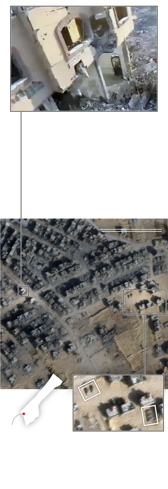
Israel fired at this building in the Tal al-Sultan area of Rafah on Oct. 16 with a tank after detecting “suspicious movement” on the upper floor, according to the Israel Defense Forces' (IDF) radio station.
Later a drone scanned the area and soldiers recognized the face of Sinwar in the rubble.
500 ft
150 m
Location of
Sinwar's killing
IDF military
vehicles
RAFAH
GAZA
Detail
This satellite image from the day of the killing shows what appears to be an IDF forward operating base or vehicle depot around 800 feet (250 meters) from the building where Sinwar was killed.
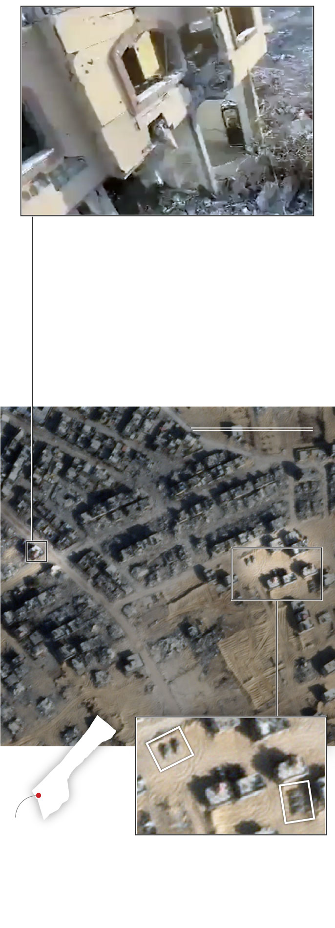
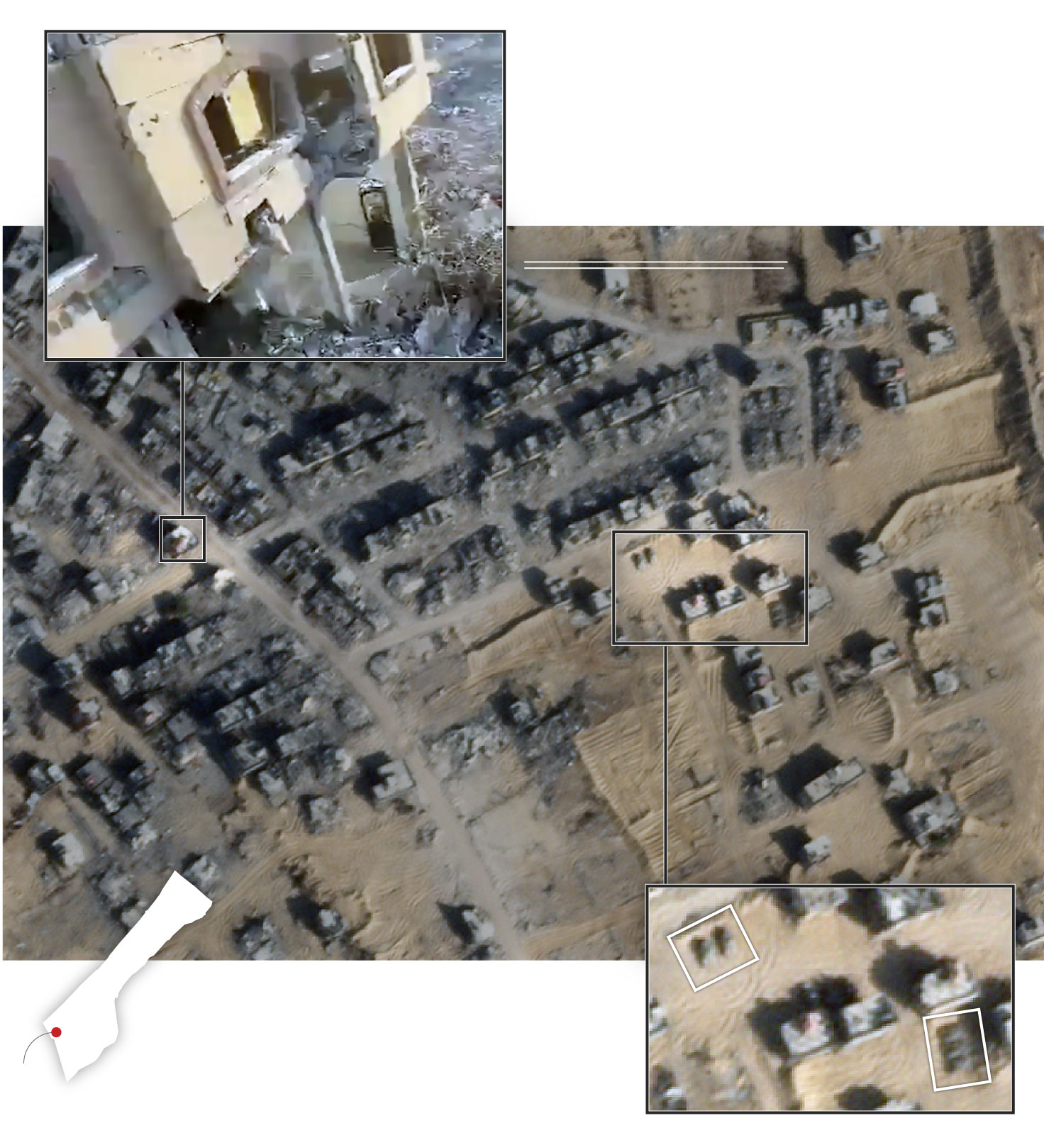
Israel fired at this building in the Tal al-Sultan area of Rafah on Oct. 16 with a tank after detecting “suspicious movement” on the upper floor, according to the Israel Defense Forces' (IDF) radio station.
Later a drone scanned the area and soldiers recognized the face of Sinwar in the rubble.
500 ft
150 m
IDF military
vehicles
Location of
Sinwar's killing
RAFAH
GAZA
This satellite image from the day of the killing shows what appears to be an IDF forward operating base or vehicle depot around 800 feet (250 meters) from the building where Sinwar was killed.
Detail

5 miles
5 km